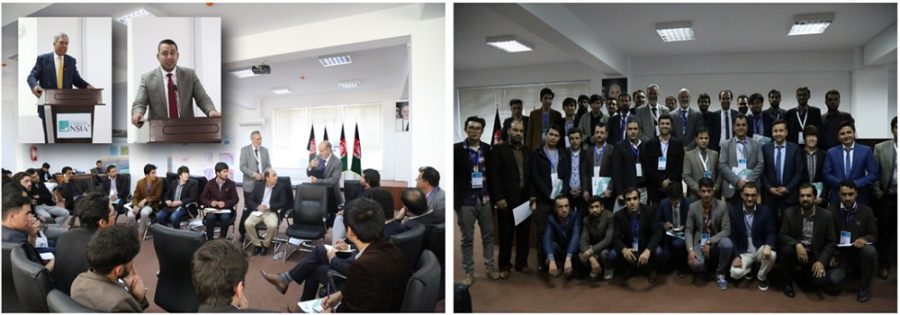
According to Mr. Mohammad Humayon Qayoumi, Acting Minister of Finance and Chief Adviser on Infrastructure and Technology to the President of Afghanistan, “Remote sensing and GIS are among the most important emerging technologies that are critical to national development in Afghanistan. Accurate and timely information is vital to our policies, our planning and our decision making at all levels of government and society”. These were the opening remarks for the Remote Sensing Discovery Day Seminar, a full-day event sponsored by the newly created National Statistical and Information Authority (NSIA) and supported by The GPC Group and DigitalGlobe.
The seminar was a senior-level, invitation-only gathering bringing together over 100 stakeholders representing over 40 government, NGO and international organizations with interests that span across different industries such as environment, mapping, agriculture, urban planning, utilities, telecommunications and security. Mr. Ahmad Jawed Rasuli, Director General of the NSIA in further introducing the purpose of the seminar said “There is a great deal of information being collected across Afghanistan every day and only now with the NSIA and its National Geo-Informatics Center (NGIC) are the mechanisms being put in place to ensure this “Big Data” is available at the right time and in the right form needed to achieve the desired benefits”.
Coming together under the theme of ‘Unlocking the Value of Geospatial Information in Afghanistan’ the main aim of the event was to create national awareness of the value of geospatial information in national development both through the public and private sectors. The event focused on how geospatial information can empower government and businesses to make better decisions, be more effective in their operations and ultimately provide significant societal benefits.
Speakers included local and international experts with extensive experience in the application of satellite remote sensing to matters that are critical to Afghanistan today. Mark Sorensen, founder of the GPC Group presented three segments addressing “The Role of Remote Sensing in the NGIC”, “Remote Sensing Basics” and “DigitalGlobe Products and Services”. Others local experts presented their work in the areas of agriculture and food security, opium eradication, water resource management and mineral exploration.
Following the main presentations, the audience was divided to four break-out groups to address the issues and priorities for the application of remote sensing to urban planning, mining and geology, environment (including natural disaster management) and mapping & statistics. Each group was then given several minutes to summarize their findings for the entire audience and these summaries are now being compiled to a concept note to be published for common reference.
Mr. Noorullah Stanikzai, the Vice President of the NSIA brought the seminar to a close, expressing his appreciation for the active participation of the attendees and the support of the GPC Group and DigitalGlobe in putting on a very informative seminar that is sure to advance interest in and use of remote sensing and geospatial technology in Afghanistan.
Mr. Rami Hamize, DigitalGlobe Senior Regional Sales Manager for the Middle East further exclaimed “We at DigitalGlobe are honored and fully committed to supporting the government, international agencies and humanitarian organizations in applying our satellite imagery products, services and platforms to the real challenges and opportunities that they are faced with. We also fully appreciate our partnership with the GPC Group in helping to advance this mission in the country, and with the NSIA in putting this technology into the hands of the people and organizations that need it most”.


